
A Whiteparish local history page from younsmere-frustfield.org.uk
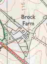
Brock Farm is on the north side of the A36 about half way between Brickworth Corner and the top of Pepperbox Hill. The farmhouse is an extension of an estate lodge built between 1842 and 1876, while the farm dates from between 1962 and 1975.
On the 1807 First Edition Ordnance Survey and 1842 Tithe Map this area is part of Brickworth Down (parcel 611). In 1842 a road from Brickworth House ran to the estate boundary on the edge of the open downland of Brickworth Down. A new Brickworth House Lodge was built at the edge of this after 1842 but before 1876, when it appears on the OS 1:2500 sheet, shown below. In 1876 this road/track is also shown extending across Brickworth Down to join the A36 opposite the northern edge of the landfill "hill" that was Brickworth Chalk Quarry, and the point where the present nature reserve boundary meets the road, at the northern end of the layby there. Along with other earlier tracks across that area of Brickworth Down, it shows up only very slightly in what is now a cultivated field on current aerial photography available on Google Earth and the Ordnance Survey. With a bit of imagination, the line may be visible on the 2002 Google aerial view. The lodge can be seen on the Historic England aerial photography, as below. Alongside this is a 2023 view of the Brock farmhouse, the form of which suggests strongly that it is based around the same building with the addition of more recent extensions.
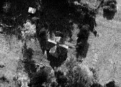
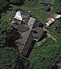
The Brickworth House lodge in 1947 viewed from the north-west; and the Brock farmhouse in 2023 (two identical images, rotated)
The centre view of the house is aligned with the left hand image, the right hand view has north at the top to match the 1876 map below
Two maps below show the road from Brickworth House ending at the edge of Brickworth Down in 1842 and with the lodge in 1876.
.jpg)
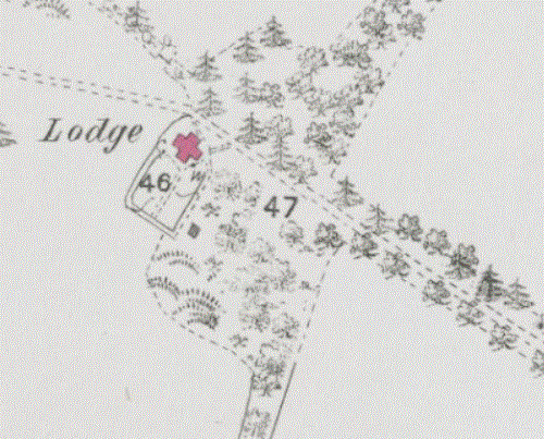
1842 and 1876 (1899 and 1924 maps also available, essentially identical)
The map below purports to be the same 1:2500 scale map as above, but shows various minor differences in the types of tree shown and detail of the garden around the lodge. [Possibly a 1:10000 scale map?]
.gif)
The Brickworth lodge on the 1926 1:2500 OS map Old-maps.co.uk
By the time of the 1962 map there were a number of other buildings near the lodge and direct access had been added from the A36. Brock Farm itself was first shown on the map labelled by Old-maps.co.uk as dating from 1975-1990.
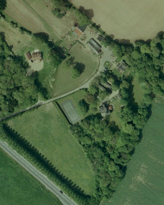
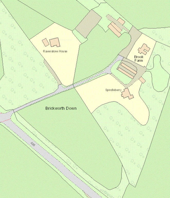
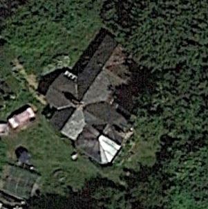
2023 view of Brock Farm (note possible name change to Brook Farm on right hand map)
* For historical accuracy, where possible on this website, the dates given for maps are the survey dates, not publication dates.